 †Zur¸ck

 - Schwierigkeit
- Erlebnis
- Schwierigkeit
- Erlebnis
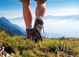
We start from the Eastern side of Llyn Cwellyn lake, by the Snowdon Ranger YHA hostel, parking lot and train station. The path is called Snowdon Ranger Path, it starts just across the road from the parking lot and 30m down the road from the hostel. Note: The first few 100m are not on the GPS track, I forgot to switch it on (sigh).
From the start of the way make your way up, passing to the left of the train station.
We just follow the track, it is well laid out and almost impossible to loose. The walk is easy and takes 2-3 hours to the summit.
We descend to the south west on the Rhyd Ddu Path. It starts at the main entrance of the summit restaurant. There are no real difficulties, but some steep slopes to the sides. After 3 hours we arrive in the village of Rhyd Ddu. From here we could take a bus or train back to the starting point (only few busses/trains)
We decide to return by foot, so we go to the other end of the village. On the way get an ice cream at the B&B. Opposite the pub there is a rusty gate, behind it starts a path marked by a yellow arrow. We follow this. Although quite flat, this actually is more difficult: in places the path is muddy and hardly recognizable, so we always look out for the yellow arrows. It goes slightly up and takes us right across the quarry, then further up, and finally meets the Snowdon Ranger Path, on which we descend to the starting point. This final section takes about 3 hours.
We use the Ordnance Survey Landranger 115 map ('Snowdon').
Mehr Info im WWW