 Zurück

 - Schwierigkeit
- Erlebnis
- Schwierigkeit
- Erlebnis
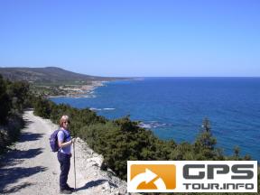
The hike is along the 9km length of the North East facing coastline of the Akamas Peninsular to the tip known as Cape Arnaoutis. This is the most westerly part of Cyprus.
There is a steepish climb at the start, but after this the hike is reasonably undemanding and flat for the most part.
The rough dirt track gradually turns to a path and at the very end becomes indistinct, although you cannot get lost as the sea will always be on your right side.
The coast is extremely beautiful with many small secluded bays and shores with white sand and blue sea.
I did this walk in late March 2004 and it was superb with light breezes and plenty of sun. I believe that it can be very windy at the cape, as it is very exposed so be prepared. Take some food, lots of water and don’t forget the sun cream and camera.
There is a small shrine at the very tip, so leave a small token of your visit.
Mehr Info im WWW
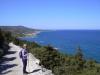 Bild 1
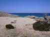 Bild 2
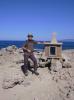 Bild 3
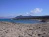 Bild 4