 †Zur¸ck
 - Schwierigkeit
- Erlebnis
- Schwierigkeit
- Erlebnis
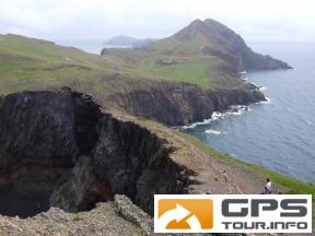
The Sao Lourenco Peninsular, on the Island of Madeira is the most easterly point on the Island.
This hike is absolutely stunning, walked on a sunny day, the colours of the volcanic lava cliffs and rocks has to be seen live, photos do not have the impact of actually being there.
The whole of the area is a World Protected site, so for the care of the wildlife, flora and not least your own safety, the marked paths must be kept to.
The hike is reasonably strenuous and you need to be sure footed. The full walk is around 7km, so do not attempt it later in the day as you may get stuck out there in the dark.
Be prepared with what you take as the weather can be very variable in Spring and Autumn and very hot in the Summer. I would advise making use of a guided tour as I did (Madeira Explorers) to make use of the invaluable knowledge of a local guide.
Mehr Info im WWW
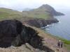 Bild 1†
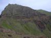 Bild 2
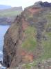 Bild 3†
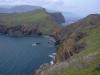 Bild 4