 †Zur¸ck
 - Schwierigkeit
- Erlebnis
- Schwierigkeit
- Erlebnis
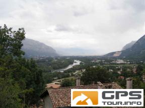
Grenoble is surrounded by three mountain ranges: Chartreuse, Vercors and Belledonnes. During this trip we visited the Vercors.
We left Grenoble following the cycling path along the right bank of Isere northwards (downstream).
We started the exhausting climb in Veurey-Voroize and travelled uphill for next 17 kilometers achieving 1100 metres of climb.
Roads were rather free of cars and after passing Montaud we have seen almost no cars at all. The reason for that was a rupture of the road shortly before the Tunnel de Mortier.
Because of the bad weather we abandoned the idea of passing the interruption and returned along the same route.
Mehr Info im WWW
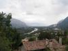 Bild 1†
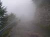 Bild 2