 Zur■ck
 - Schwierigkeit
- Erlebnis
- Schwierigkeit
- Erlebnis
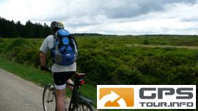
Starts in Sch—nberg at the church and follows trails through the Belgian Eifel in mixed forest and a few single trails, some technical. Can be very muddy after heavy rain, but only in a few places. O,nce in Germany you have beautiful views ovre a huge area and you are at the highest point in the region
Make a break at the Schwarzer Mann and then it is nearly all downhill back to Sch—nberg
Mehr Info im WWW
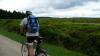 Bild 1
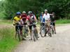 Bild 2
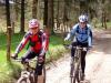 Bild 3
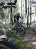 Bild 4