 †Zur¸ck
 - Schwierigkeit
- Erlebnis
- Schwierigkeit
- Erlebnis
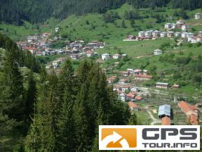
The tour is leg six of the Trans Rhodopean Trail called "Rudopia". It starts from the village of Trigrad and follows the gorge of Chairska River up to the area of Chairski Lakes which is declared a protected area. There are a few landslide lakes surrounded by lush meadows and century old spruce forests. A few more kilometers of climbing will take you to a beautifull spot with a great view of the highest part of the Rhodopes - Mt Perelik 2195 m. From this point to Mugla is only down. The village of Mugla is nicely located in the heartland of the Rhodopes and has a population of abou 200 p.
Mehr Info im WWW
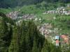 Bild 1†
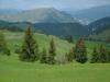 Bild 2
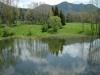 Bild 3†
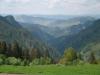 Bild 4