 Zurück
 - Schwierigkeit
- Erlebnis
- Schwierigkeit
- Erlebnis
UPDATE September 2016:
Part of the trail has disappeared in the very last 100m of this track. Farmer has decided to confiscate the trail and plough it under. The missing piece of trail is at the top of the steep climb (the steepest one in the whole track) after WP_4_R. You have 3 options:
1 - stick to the original track, do the steep climb and walk 50m across the field (where once the track was)
2 - do the steep climb (after WP_4_R) but do not cross the field, just try to find a way around the field
3 - forget the climb, in this case continue straight at WP_3_L, turn left 100m later and just backtrack the first 500m of the track.
==========================================================================
Small cross country training track of 21 km through Kranzberger and Freisinger woods (ideal for hardtail). All dirt tracks in good condition. Tour is intended for intensive condition training, it allows for high average speed (try to complete within 1 hour), and with several interesting climbs with total a little of more than 300 height meters (gpsies.com indicates 431hm but I have my doubts). Continuous up and down also makes it suitable for interval training. Tour is accesible during all the year (except in high winter when track can be covered with ice). Most of the tour is through the woods which makes it ideal for a quick ride in cold weather too.
First and last 100m of the tour overlap, so after start go straight after 100m at WP_1 when the retour path comes from your right (obviously when you come back here at the end turn left). After about 2.5km the track crosses the return path at WP_2. So at this point just go straight on both occasions when you arrive at this crossover. It also means that the tour is kind of eight-shape, with small lower clockwise circle and larger upper (northern) anti-clockwise circle.
The final climb is off the beaten track. To get there turn left at WP_3 left, this path is hard to see in summer when the grass can be high. At WP_4 turn right straight up the hill (there is no visible path) for the grand finale, a steep but doable climb that will suck the last juice out of your legs. There is a new fence here since 2016, stay on the left side of this fence. In summertime the grass can be very high here, there is no risk of nettles though (only ticks, so check your legs afterwards). Should the grass be too high for your liking (you can tell already when you turn left at WP_3), then the obvious alternative is to continue straight at WP_3, after 100m turn left and follow the first km of the route back to the starting point.
It is not advisable to do this tour in reverse direction, as the steeper climbs would be missed.
Enjoy! Please post your best time, am curious how fast this route can be done with either a fully or a hardtail.
Mehr Info im WWW
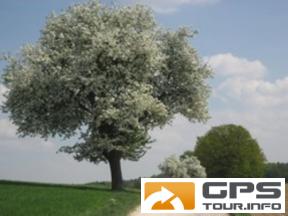
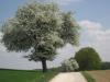 Bild 1
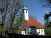 Bild 2
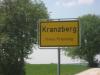 Bild 3
 Bild 4