 †Zur¸ck
 - Schwierigkeit
- Erlebnis
- Schwierigkeit
- Erlebnis
drivable way up to the Refugio Menaggio with small walk passage only.
The way up was taken from sergiomtbscialp Tour 59851 - thx, had no time to drive myself. The way up is new way to Alp Nedale and not included in commen maps (added in OSM now).
By a hiking tour from Refugio Croce di Campo to Refugio Menaggio (with the bike) i saw the new way up and the nice way down . So up on street to Alp Nedale, down nearly everything in S1-S3 singletrail.
Please drive carefuly, the way doun is in the beginning in steep alpine surrounding.
Mehr Info im WWW
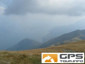
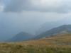 Bild 1†
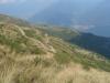 Bild 2
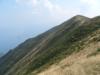 Bild 3†
 Bild 4