 †Zur¸ck

 - Schwierigkeit
- Erlebnis
- Schwierigkeit
- Erlebnis
Date: July 25, 2010
Start: 1810 m (mountain station of Planai cable car)
Finish: 826 m (Schaldming, Planaistrasse)
Highest point: 1900 m (Planai)
Lowest point: 826 m
Total ascent: 90 m
Total descent: 1074 m
Information about the Planai cable car:
href=http://www.planai.at/>http://www.planai.at/
Mehr Info im WWW
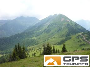
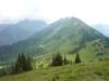 Bild 1†
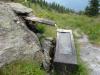 Bild 2
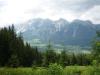 Bild 3†
 Bild 4