 Zurück
 - Schwierigkeit
- Erlebnis
- Schwierigkeit
- Erlebnis
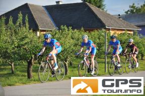
Preko 100 kilometara i skoro 1.200 metara ukupnog
uspona, nudi ova cjelodnevna zahtjevna biciklisti?ka staza.
Ruta prolazi predivnim ravni?arskim podru?jem, uz dvije
rijeke i umjetno jezero na rijeci Dravi te blizu Vara˛dina,
baroknog grada kojeg trebate posjetiti.
Over 100 kilometers long with only 1200 m of altitude difference and mostly at its beginning, best describes this trail. This trail goes through the beautiful lowland area, with a beautiful view of two rivers and along the artificial lake on the river Drava. This route will take you through lovely small towns and villages of Me?imurje region.
href=http://spa-sport.hr>http://spa-sport.hr
href=http://www.adriabike.hr>http://www.adriabike.hr
Mehr Info im WWW
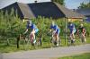 Bild 1
 Bild 2
 Bild 3
 Bild 4