 Zur■ck

 - Schwierigkeit
- Erlebnis
- Schwierigkeit
- Erlebnis
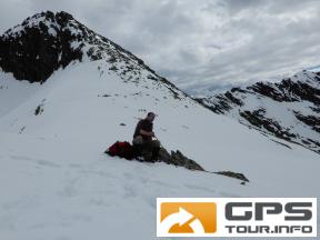
flat into the valley K—tschachtal, steep up to Reedsee (small lake), up to Palfnerscharte at around 2314 meter. then down to Palfnersee (another small lake), to verfallene Hochalm, steep down to a road through the forests for the farmers only, no traffic, down to Bad Gastein. Spectacular landscape and wide views, take care on weather, can change rapidly, stay equipped for heavy wind and rain, thunderstorm. Some water on the way. Sunblocker on sunny days. Snow up to begin of June expected.
Mehr Info im WWW
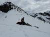 Bild 1
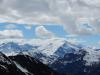 Bild 2
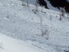 Bild 3
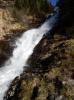 Bild 4