 Zur■ck

 - Schwierigkeit
- Erlebnis
- Schwierigkeit
- Erlebnis
short trip to Poserh—he, a mountain cabin with beverages and meals. begins at K—tschachtal steep up, nice view to valley and Stubnerkogel, the ski mountain here, to Poserh—he, down a road, no traffic, just for the farmers here. both ways possible. This is counterclockwise, if you want go up less steep, go clockwise. Can combinded with other tours I upload here. Just look for more and download all, see on basecamp and your GPS.
Mehr Info im WWW
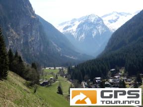
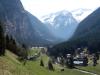 Bild 1
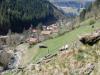 Bild 2
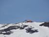 Bild 3
 Bild 4