 Zurück

 - Schwierigkeit
- Erlebnis
- Schwierigkeit
- Erlebnis
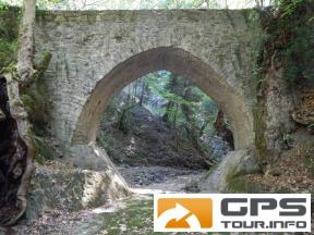
From the cemetery Tymfristos it goes downhill through the valley to the bridge Mountzouraki.
Back, at the beginning it goes over an old, overgrown footpath, then on dirt roads.
Vom Friedhof Tymfristos geht er bergab durch das Tal zur Brücke Mountzouraki.
Zurück geht es am Anfang über einen alten, verwachsenen Fußweg, dann weiter über Schotterwege.
Mehr Info im WWW
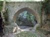 Bild 1
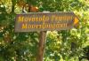 Bild 2
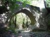 Bild 3
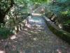 Bild 4